
Abstract
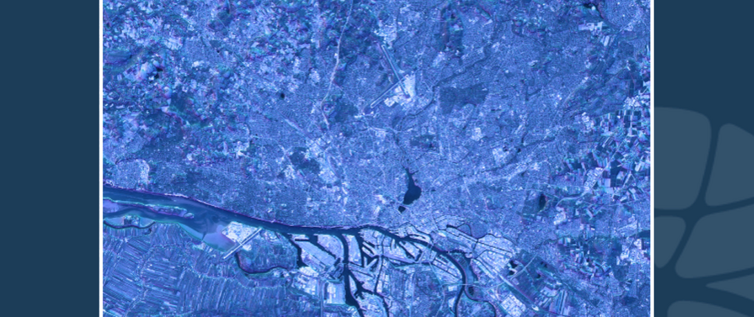
The paper explores how analysis of synthetic aperture radar (SAR) data can facilitate remote sensing to monitor activities related to nuclear fuel cycles. It presents case studies of uranium mining, uranium enrichment, and nuclear power plant sites using a variety of SAR processing methodologies. The findings illustrate both opportunities and challenges related to using SAR data for nuclear monitoring and safeguards purposes.
Introduction
Synthetic aperture radar (SAR) imagery data is already being used for nuclear safeguards purposes and its potential for monitoring nuclear fuel cycle sites is well documented [1]. SAR imagery can provide complementary information exceeding that obtained from optical earth observation sensors. The radar signal of SAR systems can penetrate clouds and is not dependent on solar reflectance, thus allowing for acquisitions under any weather or light conditions. Additionally, the signal's amplitude and phase information can be used to obtain information about subtle surface displacements and disturbances that are usually not easy to spot with optical imagery. SAR interferometry (InSAR), which exploits the information in the signal's phase difference between two acquisitions over the same area, is a particularly powerful technique that can be used for the monitoring of ground displacements that may occur because of mining-related excavation or the construction of potentially undeclared nuclear facilities.
Increasing commercialization of the space industry, more competitive pricing, and developments in processing techniques and computing hardware have made it more feasible to use SAR data as an integral part of remote sensing for nuclear fuel cycle monitoring. The following provides an overview of current opportunities using SAR data for monitoring across the nuclear fuel cycle.
Monitoring Applications
Uranium Mining and Milling Sites
Remote sensing plays an important role for the monitoring and detection of uranium mines and milling sites. While signatory States of the Additional Protocol are required to declare information about uranium miningrelated activities to the IAEA [2], satellite imagery helps the IAEA and others to acquire additional information on the mines' operational status and potential production capacity, particularly when they are in remote areas with difficult in-person access [3].
SAR imagery data can provide reliable information about operative parameters and status through the identification of ground disturbances due to vehicle movements, tilling or drilling activities, and surface displacements due to excavation or material processing and discharge [4]. A particularly promising application is the use of SAR data for the monitoring of in-situ leaching (ISL) sites. More than half of the world’s uranium resources are now extracted using ISL techniques. Extraction occurs by dissolving the minerals underground and pumping the solution to the surface for further processing. Thus, very little surface disturbance occurs and no conventional above-ground ore piles, tailings or waste rock are generated [5], making it very difficult to detect and monitor with optical imagery.
For example, Fig. 1 shows a SAR image generated over the West Mynkuduk ISL mining site in Kazakhstan compared to an optical image over the same area. While some processing infrastructure and vehicle tracks can be identified on the optical image, it is difficult to discern where the actual extraction has occurred.
Figure 1. Multitemporal coherence over West Mynkuduk ISL mining site, Sentinel-1, July 2021–July 2022, coefficient of variation in red, mean in blue (top); Google Earth/Image Landsat/Copernicus, December 2020 (bottom)
In contrast, the SAR image clearly shows human activity-related ground disturbances, making it easier to roughly identify the operative parameters of the site over time. The image was generated by calculating the multitemporal coherence over 43 Sentinel-1 acquisitions from July 2021 to July 2022. This coherent change detection method compares the phase values between image pairs across the acquisition period and is particularly well suited to identify subtle ground disturbances. The coefficient of variation (mean/standard deviation ratio) in red indicates areas with comparatively higher rates of activity within the acquisition period, while the mean values in blue indicate areas which, on average, stay constant.
Additionally, InSAR can provide information about subtle ground displacements due to the actual recovery process. Fig. 2 shows a close-up of an area shown in Fig. 1 where mining is presumed to be in operation. Compared to just being able to detect any human activity-related ground disturbances, visible on the left, one can identify and monitor the actual extraction area through the generated small baseline subset (SBAS) image and the depicted surface displacement rates visible on the right. The SBAS technique relies on an exploitation of differential interferograms to retrieve the average surface deformation velocity and residual topography and the temporal evolution of surface deformations. As the applied algorithm examines distributed features, it is most appropriate for natural features in open areas, such as those in the examined area in West Mynkuduk [6].
Figure 2. Multitemporal coherence over West Mynkuduk ISL mining site, Sentinel-1, July 2021–July 2022, coefficient of variation in red, mean in blue (left); SBAS, Sentinel-1, July 2021–July 2022 (right)
Nuclear Facilities
Remote sensing plays an important complementary role in in-person inspections and other open-source monitoring of nuclear facilities, in particular for those sites used for uranium enrichment, nuclear power generation, and spent fuel reprocessing, given their key role in the fissile material production process. As mentioned above, SAR data has unique properties that make it well suited for reliable and continuous monitoring, namely that it can be acquired under any light or weather conditions and that it can be used to identify small ground disturbances and displacements.
SAR data can play a particularly promising role when it comes to detecting undeclared sites and to monitoring declared sites where in-person access is difficult, if not impossible, for political, safety or security reasons. The following two cases serve to illustrate these opportunities.
Uranium Enrichment Sites
Uranium enrichment facilities serve to concentrate the fissionable Uranium-235 isotope in the extracted natural uranium resources. They are particularly sensitive from a non-proliferation standpoint as their capacity determines the degree to which high enriched, weapons-grade fissile material for nuclear-weapon use could be produced. However, they are characterized by few visible external signatures and are generally difficult to distinguish from any other type of industrial processing facility through remote sensing alone. Nonetheless, in States with limited safeguards obligations or in States where one suspects the construction of undeclared new facilities, remote sensing techniques play an important role. In such contexts, States may attempt to conceal their facilities and may even choose to construct them underground. SAR data is well suited to support detection and monitoring efforts of such sites because of its high sensitivity to ground surface changes.
For example, Fig. 3 shows a SAR visualization over an area in close vicinity to the Natanz nuclear complex in Iran. At this mountain site, new excavations have been identified since late 2020 and assessed to be an attempt to construct either an additional enrichment facility or a fabrication facility for additional centrifuges that could be used for enrichment at the main complex [7].
The depicted SBAS images based on a north-south descending (left) and a south-north ascending (right) right-looking Sentinel-1 image stack of respectively 201 and 192 acquisitions from 2014 to 2022 show subtle deformations that are likely linked to the ongoing excavations. The displacement rates over point areas right above the tunnel entrances shown below suggest that the strongest deformations accelerated in late 2020 to early 2021, which is indeed when the excavations started.
Figure 3. Descending (left) and ascending (right) SBAS, Sentinel-1, 2014-2022; overlaid on Planet Labs image from 19 August 2022, © 2022 Planet Labs. All rights reserved. Reprinted by permission; draped over Google Earth's terrain model.
Nuclear Power Plant Sites
SAR data can support operative perimeter monitoring at nuclear power plant sites, especially where access is difficult or impossible. Some research has also illustrated the usefulness of SAR data for post-disaster risk assessments and ground evaluations of planned nuclear power plants [8]. A particularly interesting application may be the use of InSAR techniques for infrastructural health diagnosis and related risk assessments. Progressive deformation due to age and insufficient maintenance or sudden deformation due to external shocks, such as earthquakes or floods, can occur at nuclear power plants and is a key safety risk factor.
For example, Fig. 4 shows both permanent scatterer (PS; left) and SBAS (right) results of the 5-megawatt electric (MWe) and experimental light water reactors at the Yongbyon nuclear site in the Democratic People’s Republic of Korea. Next to SBAS, PS is a key interferometric technique that exploits the phase information of point target features with high signal reflectivity and temporal stability across the image stack. As such, it is ideally suited for assessments of human-made infrastructures, such as those at nuclear power plants.
Figure 4. Yongbyon, PS (left) and SBAS (right), Sentinel-1, 2015–2022
While no substantial deformation can be identified on the basis of SBAS and PS results in this case, the millimetre-precision level data can nonetheless provide important information and confidence about the structural stability of a site which is frequently at risk of being flooded [9].
Conclusion
In conclusion, SAR data can provide unique information complementary to what can be obtained from optical earth observation sensors and other sources for nuclear fuel cycle monitoring. The case examples illustrate the usefulness of SAR data for reliable and precise multitemporal change detection assessments and SAR interferometry for ground disturbances and displacements related to operations at uranium mines and nuclear facilities.
The growing number of commercial SAR satellites and providers offering higher resolution data at lower prices has only strengthened the argument for using SAR data as an integral part of remote sensing for nuclear fuel cycle monitoring. Coupled with advances in data science and machine learning techniques enabling more automated processing and monitoring applications, it is foreseeable that the importance of SAR data for nuclear safeguards and monitoring will continue to grow.
[1] C Minet, M., Eineder, A. Rezniczek, I. Niemeyer, High Resolution Radar Satellite Imagery Analysis for Safeguards Applications, ESARDA Bulletin, 46, December 2011. M. Lafitte, J. Robin, Use of SAR data for Proliferation Monitoring, INMM - ESARDA Workshop 2011 - Future directions for nuclear safeguards and verification, 16-20 Oct 2011
[2] INFCIRC, No. 540, Article 2.a.(v), IAEA, Vienna (1998)
[3] A. Glaser, I. Niemeyer, 4. Nuclear Monitoring and Verification Without Onsite Access, Toward Nuclear Disarmament - Building up Transparency and Verification, Malte Göttsche and Alexander Glaser (eds.), Federal Foreign Office (2021) 105
[4] M. Necsoju, G. Walter, Detection of uranium mill tailings settlement using satellite-based radar interferometry, Engineering Geology, 197 (2015) 267-277
[5] In Situ Leach Mining of Uranium, World Nuclear Association, September 2020, available at: https://worldnuclear.org/information-library/nuclear-fuel-cycle/mining-of-uranium/in-situ-leach-mining-of-uranium.aspx
[6] P. Berardino, G. Fornaro, R. Lanari, B. Sansosti, A new algorithm for surface deformation monitoring based on Small Baseline differential SAR Interferometry, IEEE Transactions on Geoscience and Remote Sensing, 40, 11 (2002)
[7] D. Albright, S. Burkhard, F. Pabian, Update on New Construction Activity at Natanz, Institute for Science and International Security, 30 October 2020. D. Sanger, J. Barnes, R. Bergman, Fears Grow Over Iran’s Nuclear Program as Tehran Digs a New Tunnel Network, The New York Times, 16 June 2022
[8] J. Bestard, N. Magnall, H. Rachel, A. Thomas, InSAR as a tool to monitor nuclear decommissioning - a case study across the Fukushima Daiichi Nuclear Power Plant, Japan, EGU General Assembly 2020, Online, 4–8 May 2020, EGU 2020-16738. J. Cyziene, V. Minkevicius, V. Mikulenas, J. Satkunas, Results of persistent scatterer interferometry of the new planned Visaginas Nuclear Power Plant area, Lithuania, Geologija, 54, 4 (2012) 136-154
[9] P. Makowsky, F. Pabian, J. Liu, J. Town, North Korea's Yongbyon Nuclear Center: Significant Flooding of the Kuryong River, 38 North, 12 August 2020